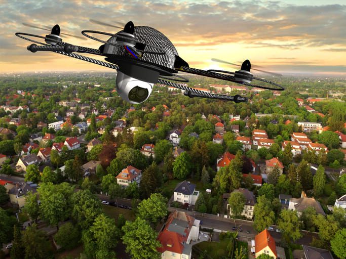
Urban planning and development: they grapple with a plethora of challenges that range from the meticulous management of infrastructure, to accommodating population growth — all while preserving natural resources. Often traditional methods for data collection and analysis prove inadequate in yielding comprehensive insights into urban landscapes; this shortfall results in inefficiencies and less-than-optimal outcomes. The emergence, however, of drone photography services has ushered in a revolution within this field – providing planners with an unprecedented bird’s-eye view of their environments. This technology empowers them to create sustainable cities by enabling informed decisions on developments that promote livability within these urban areas more effectively than ever before.
Informing Decision-Making Processes
Drone photography services collect valuable aerial imagery and data, which serve as crucial tools for informing decision-making processes in urban planning and development. Through the analysis of these aerial images and videos, planners or developers gain essential insights into population density; transportation networks; spatial resource distribution – all pivotal factors for designing efficient sustainable urban environments. This approach driven by data empowers stakeholders to prioritize resident needs with well-informed decisions while fostering economic growth along environmental stewardship.
Streamlining Mapping and Surveying Activities
Often, traditional methods of mapping and surveying prove to be both time-consuming and labor-intensive; they necessitate ground-based equipment as well as manual measurements. In contrast—drone photography services provide an alternative: a more efficient approach that captures accurate spatial data over large areas at reduced costs. Equipped with GPS technology and advanced sensors, drones swiftly gather precise geospatial information—elevation data, land contours, building heights—with accuracy unmatched by their human-operated counterparts. The planning and development process accelerates with this streamlined approach to mapping and surveying; project timelines diminish, while costs reduce.
Gaining a New Perspective
High-resolution camera-equipped drones offer a unique viewpoint, unattainable through traditional photography methods. An aerial videographer can capture aerial images and videos to present planners and developers with an all-encompassing view of urban areas; this includes infrastructure details, land use patterns – even environmental features. Stakeholders gain an eye-opening perspective that enables them: it identifies not only potential challenges–traffic congestion, green space availability or flood risk areas–but also opportunities for informed urban development projects.
Facilitating Community Engagement
Active engagement with local communities is a prerequisite for effective urban planning and development: it ensures that projects align not only to residents’ needs but also their preferences. In this process, drone photography services serve an indispensable role; they provide visualizations – through aerial images and videos – of proposed developments along with their potential impacts–a function vital in facilitating community engagement. These tools thus enable residents to envisage the suggested alterations within their neighborhoods; importantly, fostering transparency dialogue–and collaboration between stakeholders become inevitable outcomes. Urban planners and developers, through the incorporation of community feedback into their planning processes, can forge urban environments that are more inclusive and sustainable.
Monitoring and Evaluating Progress
Drone photography services are critical for monitoring urban development projects throughout their course and assessing outcomes. Aerial footage provides real-time updates on construction, infrastructure installation, and environmental changes, offering stakeholders a clear view of progress and performance. This aerial surveillance helps planners detect and address issues quickly, maintaining project timelines and budgets. Post-project drone photography helps evaluate project success and extract insights for future projects.
Enhancing Environmental Sustainability
To achieve sustainable urban development, we must meticulously consider environmental impacts and conservation efforts. Services like drone photography play a significant role in promoting environmental sustainability: they supply crucial data for ecological condition assessment and habitat change monitoring. Through aerial imagery identification, we can pinpoint areas of ecological importance – wetlands, forests, wildlife habitats – that might require protection or restoration; this is an invaluable tool towards our goal. Stakeholders, through the integration of environmental considerations into urban planning processes, can: mitigate negative impacts on natural resources; enrich biodiversity – thus fostering resilient urban ecosystems. This strategy not only benefits people but also contributes towards planetary health.
Urban planning and development revolutionize as drone photography services offer a fresh perspective on urban landscapes, supplying crucial data for decision-making processes. Drones play an essential role in crafting sustainable and livable cities; they provide insights into the environment, streamline mapping activities, facilitate community engagement and monitor project progress. By leveraging aerial imagery’s power along with pertinent data analytics it empowers urban planners – developers – policymakers to shape future cityscapes that prioritize people: prosperity–and the planet.
Disclaimer: This article contains sponsored marketing content. It is intended for promotional purposes and should not be considered as an endorsement or recommendation by our website. Readers are encouraged to conduct their own research and exercise their own judgment before making any decisions based on the information provided in this article.


